
Today (6/18/25): Wednesday is going to be one of those summer days that might be best spent indoors. The day will start off with winds that are calm from the east. Overcast skies will take hold in the morning due to the next approaching weather maker. Showers and thunderstorms associated with a low pressure system will be approaching from the southwest during the early morning hours. It’s likely that it will start raining predawn before you get your day started. Overcast conditions will persist along with showers and isolated thunderstorms throughout the whole day. In addition, the Storm Prediction Center had outlined Milwaukee in a slight risk of severe weather. However, recent model runs have shown that most of the severe weather will remain south of the Milwaukee area. We cannot rule out some gusty winds and heavy rainfall associated with any thunderstorms that do impact the area. As this low pressure moves through, winds will shift to the northeast around 10 mph. Our temperatures will stay in the high 60’s to near 70 degrees due to the thick cloud cover from the showers and storms. Lastly, you might notice a small drop in the humidity through Wednesday evening as showers and isolated thunderstorms finish moving through.

Tonight: Showers will be finishing up by the late evening (around 8 p.m.) on Wednesday night. Light winds will shift from the northwest gusting around 10 mph behind the low pressure system that passed during the day. Temperatures should dip down into the low 60’s with cloudy conditions continuing overnight.
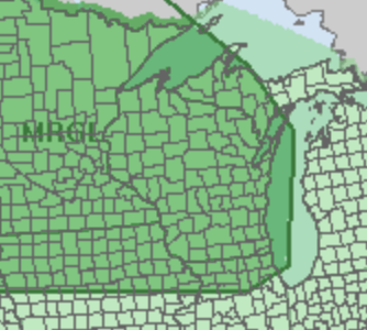
Tomorrow (6/19/25): Clouds will slowly begin breaking by early Thursday morning (around 7 a.m.) then sunshine takes over for the majority of the day. High temperatures will begin to rise and top out in the high 70’s to near 80 degrees with calm east winds. The humidity will be a factor again with dew point temperatures rising back into the mid 60’s. This in turn will lead the atmosphere to become slightly unstable by the afternoon. Therefore, the Storm Prediction Center has issued a level 1 out of 5 risk of severe weather for all of Wisconsin. This is a very conditional risk (only about a 20% chance). If storms do flare up, the main risk would just be some gusty winds and heavy downpours. After 10 p.m. the storm chances will subside and mainly clear skies will be in place over night. Low temperatures should be in the high 60s overnight with calm winds turning to the southwest.
Friday-Sunday: A big heat wave is on the way for this coming weekend. Friday will begin a hot stretch of weather reaching into the high 70’s to near 80 degrees. There will be another 20% percent chances of showers on Friday afternoon, but no severe weather is expected. Saturday the heat really begins to show with highs topping out around the low 90’s. Skies will stay clear and mostly sunny through Sunday which will feature more of the same high temperatures. Dew points will also be on the rise into the sticky high 60s degrees to near 70 degrees making temperatures feel like 100 degrees. Make sure to stay hydrated and take frequent breaks in the shade if outside.
