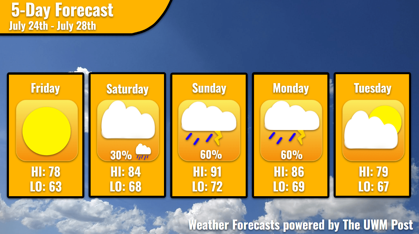
Overview: Milwaukee’s 5-Day Weather Forecast July 24th, 2026, begins sunny and temperate until the weekend turns cloudy with possible precipitation. Additionally, the heat returns.
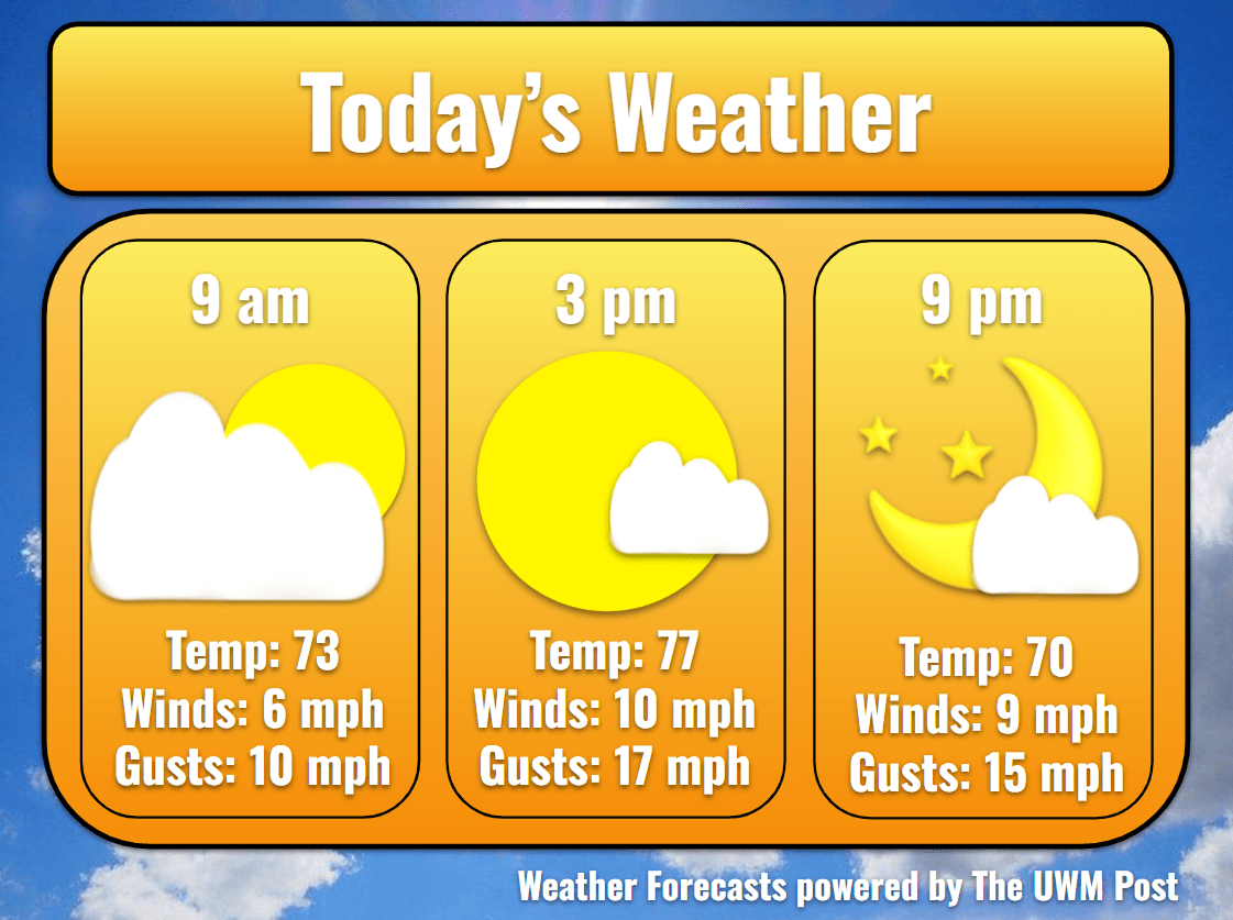
Today: Sunshine breaks through after high clouds attempt to block the sunrise. With a supporting southwestern wind at 8 mph, temperatures rise steadily to the upper 70s, topping out at 78. Gusts should not reach 25 mph until the night. With Lake Michigan’s water at 72 degrees, a full day at the beach sounds fantastic. Clouds return in the afternoon, sticking around until sunset.
Tonight: Clouds increase early in the night to signal the motion of a northern low-pressure system. Also increasing the winds, gusts of 25 mph more often occur. Temperatures drop to a seemingly brisk 63. We do not see this low of temperatures until later next week, if at all.
Tomorrow: Clouds hold some rain in the morning and might drop a few drizzles around the city, but nothing too significant. Brought on by the stronger southwestern winds with similar gusts, temperatures launch up to 84. We continue through the day under a bit of clouds which thicken in the early night. Storm system from the north causes this, as it dissipates reaching Southeastern Wisconsin. By the time its clouds leave for Indiana, temperatures will have dropped to 68.
Sunday: Sunday morning might see the beginning of heat advisories in Wisconsin until Tuesday. Without many clouds hindering a late July sun and 8-mph winds from the southwest, temperatures return to the 90s. Topping out at 91, dewpoint also return with a fury at 72, sending feels-like temperatures into the 100s. Riding on this increase of instability in the atmosphere, storms become possible in the evening. These likely break up before the Milwaukee metro as they come down from the north. Higher rain totals are expected to be in the north, but the rain ends around midnight. Temperatures fall to a sticky 72 overnight.
Extended: Dependent on the strength of Sunday’s storms, Monday’s makes up for it. If Sunday proves stormy, Monday might see a few showers, whereas if Sunday proves slightly rainy, Monday becomes stormier. Monday temperatures remain quite fluid as of yet, depending on the timing of the cold front’s eventual arrival. Expect temperatures to be rather hot in the morning and with dewpoints nearing the mid-70s. After the front, lingering southern winds might boost the sun’s energy to send Milwaukee into the 90s, or without consistent winds anywhere from the west, temperatures might only stay in the mid-80s. Clouds frequent the sky all the while but still remember to apply your sunscreen and to drink water! Otherwise, Monday ends with a low of 69. Tuesday relatively cools down thanks to a helpful development of high pressure over the western Great Lakes. This sends northern winds blowing through at 9 mph with gusts up to 26 mph and a temperature up to 84. In the night, temperatures and winds ease, hitting 67 degrees with gusts up to 20 mph. Despite the uncertainly, please plan carefully, and remember to come back here for your weather tomorrow!