

Overview: Milwaukee’s Weekend Weather Report November 7th, 2026, starts with some wind and rising temperatures, hits 60 degrees with a bout of rain, only to possibly see snowflakes on Thursday.
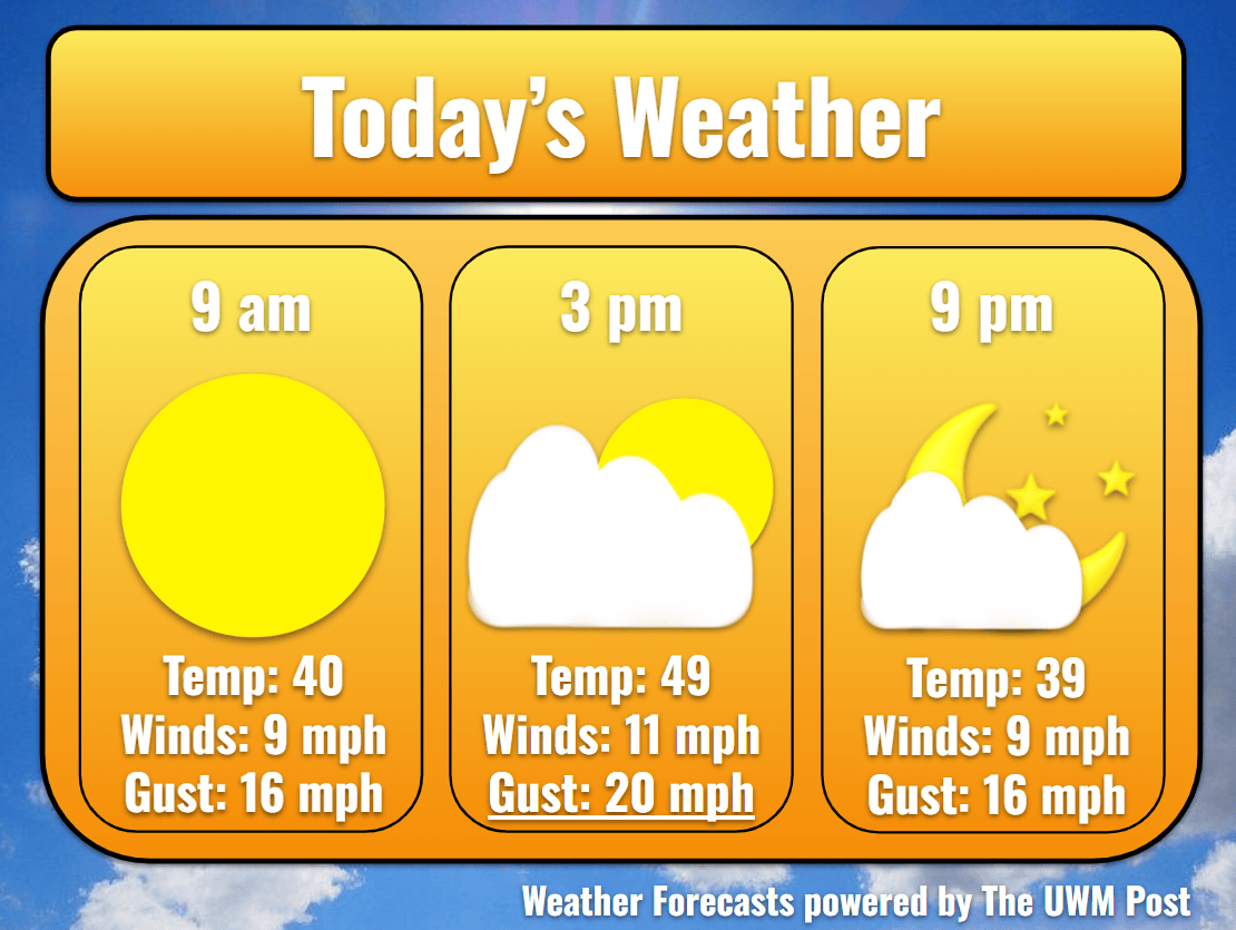
Today: After a frigid night, Milwaukee wakes up to temperatures returning to the 40s. Morning sunshine gives temperatures the extra boost to reach 49 for the afternoon high. Riding atop western winds of 10 mph and gusts up to 25 mph, clouds enter the skies at 10 a.m., turning the sunshine into sporadic sunrays. These clouds linger until the afternoon, breaking up for a beautiful sunset. High pressure dominates the day.
Tonight: Pressures drop noticeably overnight as a low sinks down near Lake Superior. Increasing our clouds for the night, this low also increases the winds to 15 mph by tomorrow morning. For any trying to ward off the cold weather however, this wind bodes well, as it raises the nightly low more than four degrees from last night to 38 tonight.
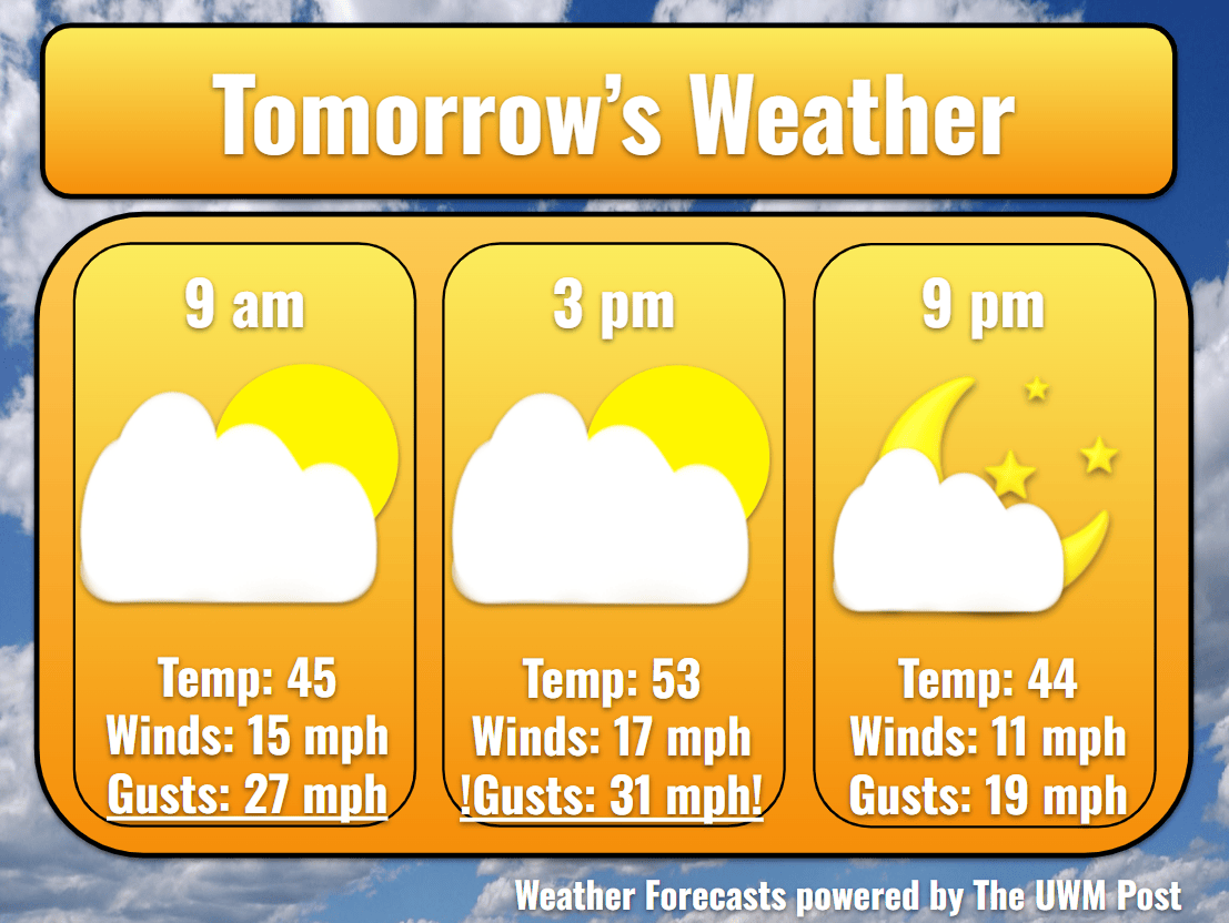
Tomorrow: Western winds average 15 mph with gusts up to 35 mph, starting southwestern and turning northwestern by nightfall. Please exercise extra caution when driving today. As warmer air gets shoved into Southeastern Wisconsin, Milwaukee warms to 57 in the afternoon. Clouds break a bit in the afternoon as well, but fill back in again by 6 p.m.
Tomorrow Night: Temperatures still get down into the 30s thanks to that northwestern wind. However, winds do calm down overnight, slowing to 20-mph gusts just in time for the Monday morning commute. Clouds break apart before Monday’s sunrise as well.
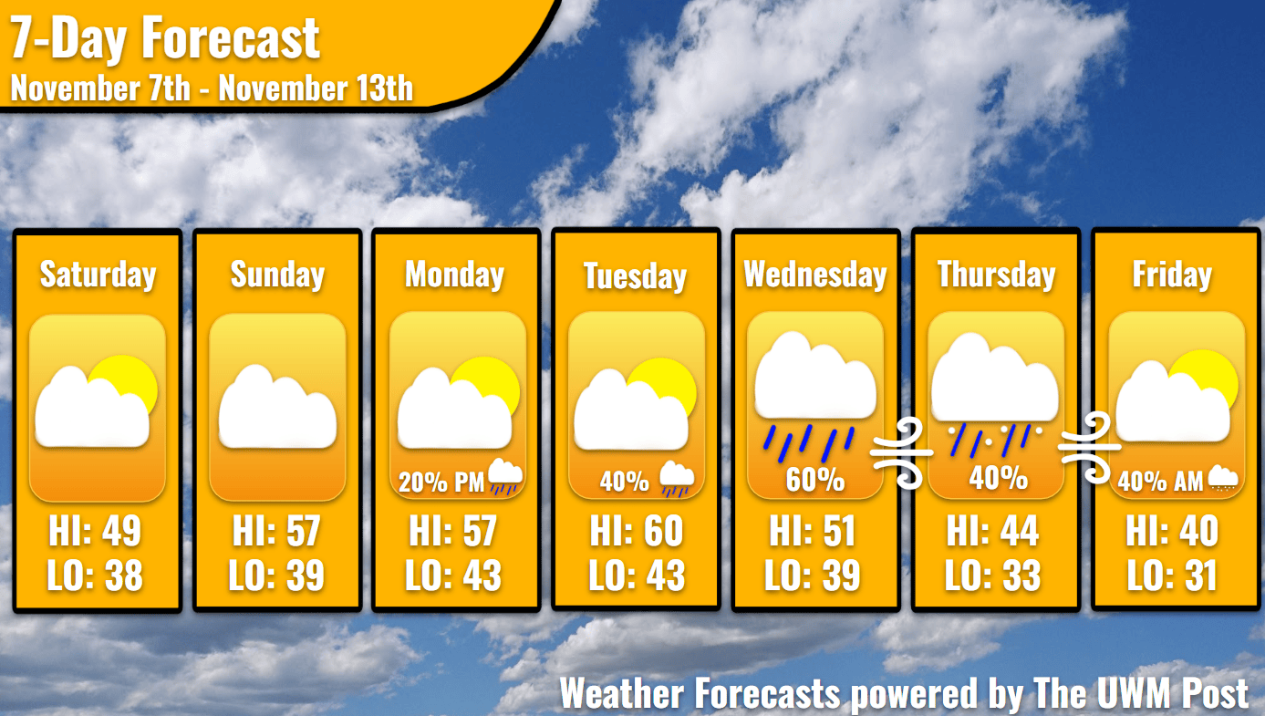
Monday: The morning commute should get along without a hitch, as Milwaukee enjoys a brief high-pressure influence from the west. The high temperature remains the same as Sunday: 57. Blue skies and warmth cannot last forever in Wisconsin November, though. Into the afternoon, clouds gather, and precipitation chances increase to 20% during the latter half of the day. A low-pressure system swings over the Northern Great Lakes, sending some potential rain clouds to the south. Along with this, winds jump up to blow from the southwest at 12 mph, gusting up to 26 mph. Thanks to the clouds and winds, the low temperature only drops to 43.
Tuesday: These clouds become scarce Tuesday morning, as the golden morning greets the blue of the sky. Boosted again by warmer winds, temperatures float up to a high of 60. As the low pressure exits to our northeast, winds turn and come from the northwest by evening still averaging 10 mph. Gusts lighten a small bit to 24 mph. Lagging behind the low, a smaller connected system poses a larger precipitation threat than before. A 60% chance for rain continues from late afternoon until Wednesday morning.
Wednesday: The drizzles leave for the southeast as the low catches up to its counterpart. Despite this, moist air continues in from the northeast behind the system, ahead of the entering high pressure. With winds turning to come from the northeast by nightfall, temperatures struggle to hit 50 degrees. Only thanks to momentarily broken cloud cover at midday does temperatures hit 51. Afterward, the past system’s moisture comes out of the northeast in the form of clouds and drizzly weather. Temperatures above and at 3000 feet are now sub-freezing, and it only takes a little more northeastern wind to send the rest of the needed cold air to us on the surface. On Wednesday night then with a stronger wind, temperatures plummet around Southeastern Wisconsin. The first snowflakes become a real possibility. Temperatures near the lake however remain in the upper 30s, warding off any accumulation for the time being.
Thursday: These scattered drizzles lighten Thursday morning. Mixing with Lake Michigan’s moisture, the clouds now have a bit more fuel to continue their precipitation in Southeastern Wisconsin. Thursday reaches a high of 44 only to cool quickly into the night. Rain likely turns to snowflakes by the night of Thursday. This system is still being resolved and predicted, so please understand the forecast could change to rain. Current weather models disagree on snow accumulation into Friday morning, however, please stay updated with your local weather. Estimations currently would place the amount of snow Milwaukee receives at one tenth of an inch. A concern would be travel near the lakefront, including the interstates as this is seemingly a lake-enhanced snow event. Furthermore, some gusty winds enter Southeastern Wisconsin on Thursday, reaching a possible 40 mph. Stay safe!
Friday: Snow stops in the morning and the clouds lessen. Temperatures now struggle to reach above 40 degrees. Winds remain high, but calm to a maximum gust of 30 mph. A low of 31 seems highly likely at this point.
This is absolutely fabulous. Love the description of each day. This is so helpful and descriptive. Thank you so much