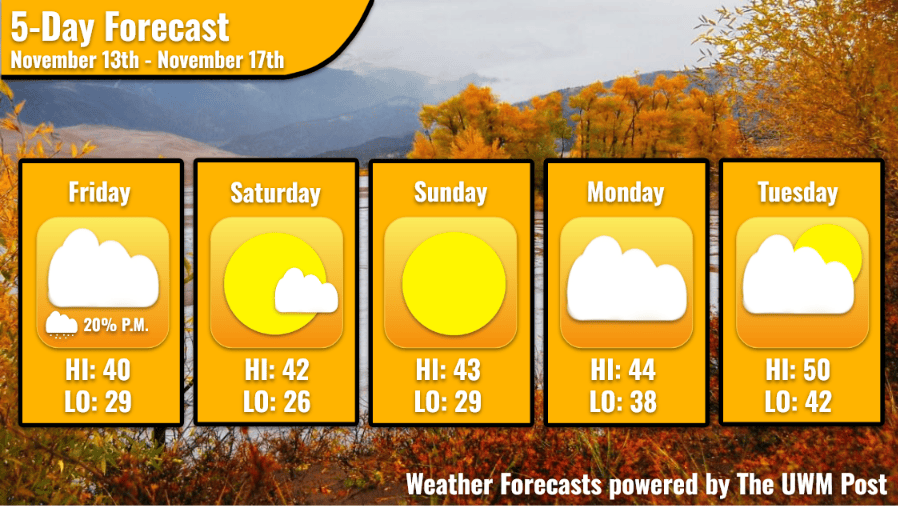
Overview: After a cold start to the weekend, temperatures rise into the mid 40s starting on Sunday, caused by a high pressure system moving into the area.
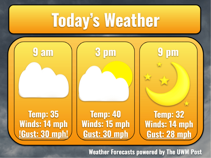
Today: After a 25% chance of snow before 9 a.m, skies turn to partly cloudy on Friday. Temperatures start off in the lower 30s before warming up into the lower 40s for the remainder of the day. Strong winds blow out of the north at 15 mph with 30 mph gusts at times.
Tonight: Clear skies move in around 9 p.m, leading to a chilly night in the upper 20s. Winds continue to blow out of the north, speeding up slightly to 18 mph with 32 mph gusts along the lake.
Tomorrow: Skies remain clear during the morning on Saturday, before shifting to cloudy around 3 p.m as a high pressure system moves in. Temperatures warm up slightly, hitting a high in the low-to-mid 40s with winds slowing down considerably to 8 mph. Temperatures fall again on Saturday night, bottoming out in the mid 20s in some areas.
Extended: Sunny skies linger over Milwaukee on Sunday, leading to warmer temps in the mid 40s. Winds remain slow out of the west, blowing at 4 mph with the occasional 10 mph gust. Temperatures rise further on Monday, hitting highs in the mid-to-upper 40s with mostly cloudy skies. Winds speed up slightly, moving out of the southwest at 8 mph. A heatwave moves through the area, causing temperatures to hit in the lower 50s. Skies clear up slightly, with winds out of the south at 5 mph.