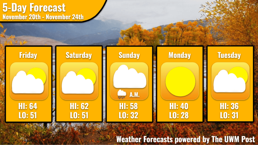
Overview: High pressure and a cold front dominate the weekend weather, causing temperatures to drop on Sunday.
Today: High pressure dominates the weather on Friday, leading to partly cloudy skies for most of the day. Warm, southerly winds at 10 mph with 18 mph gusts boost temperatures into the mid 60s, leading to one last boost of warmth before winter comes.
Tonight: Skies start to clear around 2 A.M. dropping temperatures into the lower 50s. Winds continue to blow out of the south at 12 mph, with 20 mph gusts expected at times.
Tomorrow: Temperatures quickly max out in the lower 60s before tapering off into the upper 50s with winds that shift to blowing out of the south at 12 mph, slowing down as the day goes along. Skies start off clear, but clouds increase as night starts to fall finally becoming cloudy after 9 P.M.
Extended: A cold front moves through the area on Sunday, causing rain to fall in the morning and temperatures to drop into the lower 40s after 9 A.M. Winds shift to blowing out of the west at 8 mph, with clouds lingering after the cold front moves through. Clear skies return on Monday, with temperatures dropping into the lower 40s. Winds blow out of the north at 6 mph. Tuesday is very similar, with muted temperatures in the mid 30s and mostly cloudy skies throughout the day.