

Overview: Milwaukee’s 5-Day Weather Forecast July 26th, 2026, heats up Sunday, sees severe storms pass through before midday Monday, possibly hits 100, and cools down later.
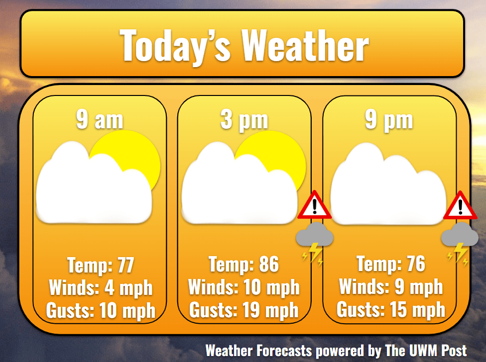
Today: Starting in the 70s, scattered rain pops up around Southeastern Wisconsin with a scarce heavy downpour. Exiting over the lake by 9 a.m., temperatures in Milwaukee launch up to the upper 80s with a broken-cloud sky. Near the lake, we top out at 88. Winds hail from the southwest to the tune of 10 mph with gusts seldom breaking 20 mph. In the late afternoon, storm chances steadily increase to 80% by 10 p.m. with dewpoints in the low-70s. Any storms produced in the evening would only produce some lightning, localized downpours, and gusts upwards of 30 mph. This would help to reduce the severity of the storms in the night and likely the temperatures of Monday.
Tonight: If no pop-up storms occur, Milwaukee is in for quite a night. Arrival stays debatable on timing, but within the eight hours following 11 p.m., an organized storm line enters Milwaukee. The main swath ends within two hours, but occasional storms persist until 9 a.m. Monday. This storm could produce winds near 60 mph, quarter-sized hail, and pooling water on roadways and in ditches. I write “could” due to the possible evening storms. In the case of a few evening storms or rain, models show potentially more forgiving storms in the morning. Stay alert with weather updates from the National Weather Service and your mobile devices. Temperatures do however drop to 67 with the passing of storms.
Tomorrow: After blowing away, dependent on last night’s storms and lingering clouds, temperatures could be nicer or worse. Without any substantial storms, Milwaukee might experience its first 100 degree day of the year. With significant storms, especially towards the morning, temperatures might stay within the 80s. Otherwise, precipitation chances spike again in the evening, with likely scattered drizzles until the setting of the sun, somewhat visible around 8:15 p.m. By then, the winds now come from the north at 12 mph and gusts of 25 mph. Thanks to the exiting low pressure, cooler weather rides on the winds, despite the low for the night being 71.
Extended: Much more temperate weather is on its way, with highs for the next days in the upper 70s and lows in the mid-60s. Each day features some morning sunshine, an afternoon lake breeze, and partly cloudy evenings which clear into the night. Tuesday may find some rain in the cloudy evening due to lingering humidity, but not much. Decreasing into Thursday, winds start out strong from the north at 12 mph with gusts of 27 mph. Average wind speeds fall to 8 mph Wednesday and finally calm to 4 mph from the east on Thursday. Gusts finally rest on Thursday, only hitting 16 mph. Mid-week weather is brought to you by an entering high pressure which stagnates over Wisconsin on Wednesday and leaves later Thursday.
