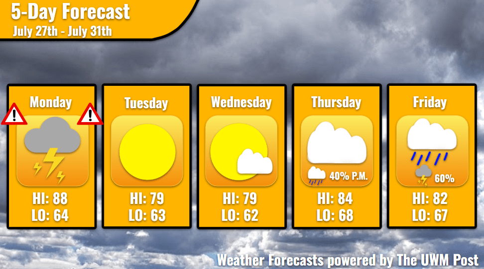
Overview: Milwaukee’s 5-Day Weather Forecast July 27th, 2026, starts stormy and hot, but cools down into the mid-week, and brings back another round of rain to finish out our July.
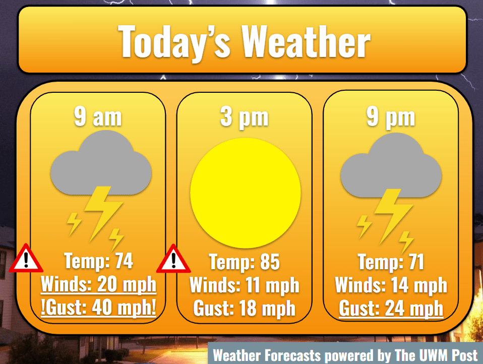
Today: Morning storms slam Milwaukee, leave around noon, allow temperatures to hit 88, and evening thunderstorms end around 10 p.m. If the atmosphere maintains overnight instability, storms turn severe over the early morning in the north before entering Milwaukee by 10 a.m. Gusts could whip down I-41 over 50 mph with hail larger than a quarter coming behind. Additionally, locally heavy rainfall could lead to flooding on roadways, so be especially vigilant with driving. Morning commuters should stay alert with the weather, due to timing still being debatable. However, storms should end by noon. Their passing allows some sunshine to peek through, but this spells a bit more trouble for Milwaukee. Temperatures spring up to 88, and western winds of 12 mph blow in humid air, launching feels-like temperatures into the 90s. Because of this, the atmosphere regains instability and sprouts scattered thunderstorms for the evening.
UPDATE 6:30 a.m.: Storms are entering later than expected with a more eastern track. This brings more winds from the southwest and raises temperatures. Still stay alert.
Tonight: Evening thunderstorms drop another tenth of an inch of rain. Gusts could reach 35 mph, and hail could fall in highly isolated cases. Afterward, temperatures relax into the mid-60s for the night, dragging the dewpoint down as well. This means fog covers a good portion of Southwestern Wisconsin until Tuesday morning. In contrast, winds continue at their 12-mph pace, but now from the north.
Tomorrow: Thanks to the passing of the low-pressure system Monday, winds stay out of the north and begin to calm into Wednesday. Tuesday still holds the possibility of 30-mph gusts, but this keeps Milwaukee cool. Temperatures stay within the upper 70s. Dewpoints fall into the 50s by the day’s end. Without many clouds, a beautiful sunset ends the day. Some smoke from fires out west sits in the sky above, so a full palette of oranges and reds should be in store. Stay tuned for any air quality alerts, though. A low of 63 puts Milwaukee to sleep for Tuesday.
Wednesday: A re-run of Tuesday, Wednesday temperatures stick near 79 degrees under mostly sunny skies. Winds calm to 6 mph from the northeast, gusting up to 25 mph. Dropping to 62 in the night, Milwaukee enjoys another peaceful weather night.
Extended: Thursday begins like Wednesday, but temperatures turn warm with southwestern winds. The high pressure of the mid-week exits to the east, sending Milwaukee temperatures into the mid-80s. Winds stay calmer, but increase into the night. A chance for rain also exists for Thursday, especially in the evening, but this calms down in the early night. Temperatures slide down to 68. Early Friday morning might see a thunderstorm which ushers in greater chance for rain later. Rain-filled clouds persist into the evening when thunderstorms pass through again. On Friday, temperatures reach the 80s but shouldn’t go into the upper 80s, and they fall to the mid-60s in the night. With such weird weather, stay updated and safe!