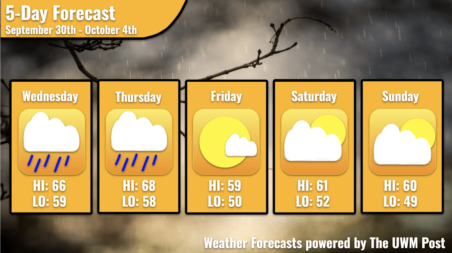
Overview: A wet next few days for Milwaukee with rain expected on Wednesday and Thursday. Temperatures are also expected to decrease over the next few days.
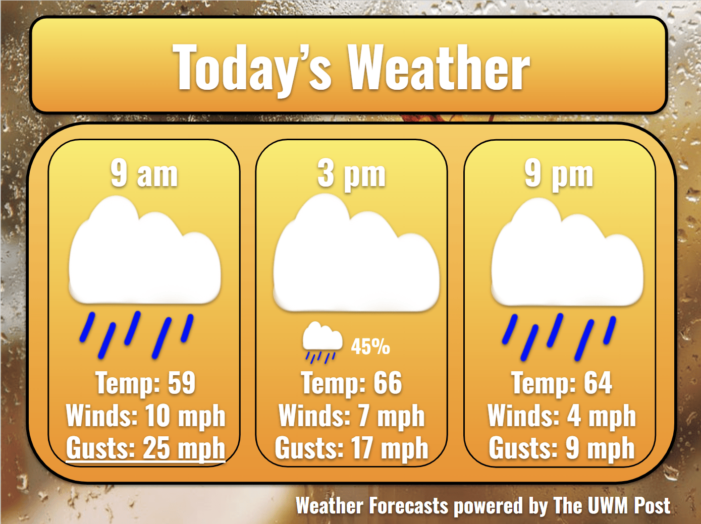
Today: Wednesday morning for Milwaukee starts off wet, with 90% chance for rain in the forecast. With that, temperatures reach up to 59 degrees with 10 mph winds from the south, gusts reaching up to 25 mph. As the day continues, rain accumulations are expected to reach up to around a quarter inch as more showers roll in throughout the afternoon. Along with the rain, temperatures are expected to reach a high of 66 degrees with winds slowing down to 7 mph with gusts up to 17 mph.
Tonight: Into the evening hours on Wednesday, more showers are expected with rain accumulations reaching up to around a half inch. Temperatures drop slightly to 64 degrees with wind speeds slowing down to 4 mph with 9 mph gusts.
Tomorrow: Thursday morning brings more rain for Milwaukee with a 90% chance for showers. Temperatures are expected to reach up to 66 degrees with wind speeds at 4 mph with gusts up to 10 mph. With the gloomy, rainy weather here, a cold front is located in Northwestern Minnesota making its way eastward. With that in mind, temperatures are expected to drop within the next few days. Into the afternoon, 85% chance of rain is expected with rain accumulations reaching to around a half inch throughout the day. With that, temperatures reach a high of 68 degrees with wind speeds picking up to 10 mph and gusts reaching up to 22 mph, due to the cold front arriving. Into the evening hours, the rain is expected to slow down with a 60% chance for scattered showers. Along with that, temperatures plummet to 58 degrees with wind speeds reaching up to 8 mph with gusts reaching to 18 mph.
Friday: Friday starts off chilly with temperatures reaching into the low 50s with partly cloudy skies. The high-pressure system will start to clear out clouds and decrease the wind speeds throughout the morning and afternoon. With that, wind speeds reach up to 9 mph with gusts up to 16 mph. Into the afternoon, temperatures reach a high of 59 degrees with clear skies. Wind speeds reach up to 10 mph, gusting up to 20 mph. The evening brings in cooler temperatures in the low-50s and clear skies again due to high pressure now located in the Upper Peninsula. Wind speeds slow down to 5 mph with gusts reaching up to 12 mph.
Weekend Outlook: With the weekend here, Saturday brings a high of 61 and a low of 52 with wind speeds in the morning averaging out around 6 mph and the afternoon averaging out around 5 mph. Mostly cloudy skies are expected in the morning. However, clouds become more common with overcast skies expected in the afternoon hours. A maximum wind gust up to 13 mph is expected throughout the day. Sunday brings similar temperatures with highs reaching up to 60 and a low of 49 with wind speeds in the morning averaging out around 6 mph and the afternoon averaging out around 12 mph. Clouds are to be common in the morning but are expected to clear out to partly cloudy skies by the afternoon. A maximum wind gust up to 25 mph is possible in the afternoon. Stay tuned for more weather updates!