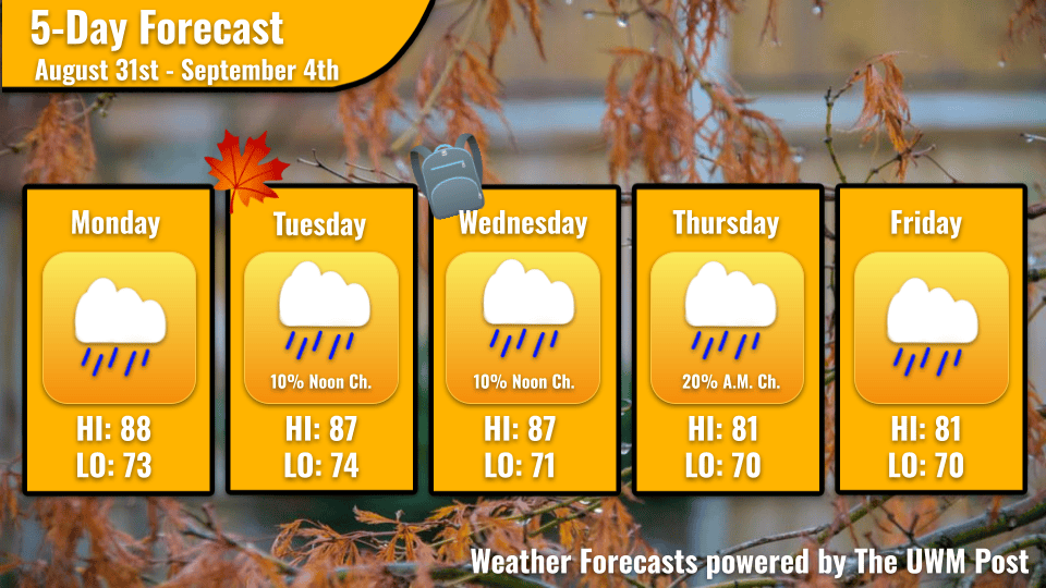
Overview: A semi-stationary front brings rounds of rain throughout the week with a chance for severe weather. Most days will be hot and humid with partly cloudy skies and scattered showers.
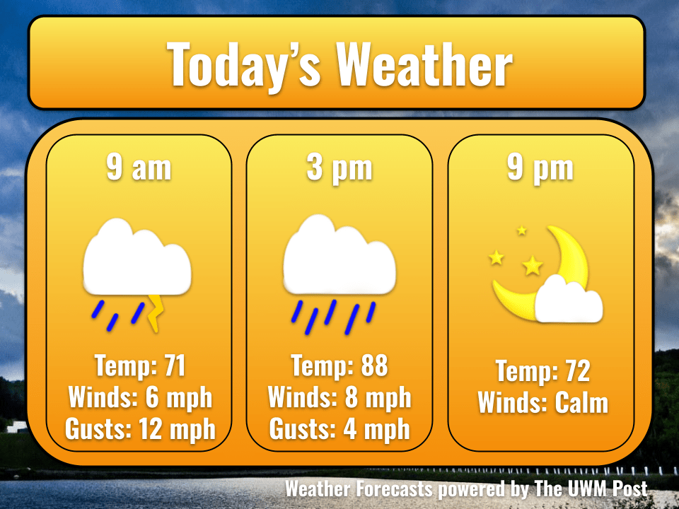
Today: This Monday heads an important week for the fall, with September 1st bringing the official start of meteorological fall and September 2nd kicking off UWM’s fall semester. However, I must be the bearer of bad news and tell you it comes with some less-than-admirable weather. A warm front marching over the city has provided us with sticky temperatures and rounds of showers, which will first greet us early Monday morning. These showers will be short-lived and likely dissipate before you leave your home in the morning, providing temperatures of 72 degrees. After that, high dewpoints near 70 degrees will dominate the afternoon. Combined with today’s high of 88 degrees, these oppressive temperatures are going to feel nearly tropical. Winds peaking at 8mph in the afternoon will calm to a slight breeze as the evening nears.
Tonight: This evening, expect another smaller round of rain in the late afternoon followed by partly cloudy skies and warm temperatures. Overnight, the temperature will drop to 73 degrees, although dewpoints will remain high.
Tomorrow: These tropical temperatures and humidities will persist into Tuesday, with a morning low of 75 degrees. As the day continues to warm, expect high temperatures of 88 degrees and the potential for more pop-up showers in the late afternoon to early evening. As dynamics in the atmosphere shift, a Level 1 Marginal Risk has been issued by the
Storm Prediction Center for southern Wisconsin (as seen below). All this means is there’s a possibility for strong winds and potential hail along with these showers, but not a huge margin for much else.

Extended: The same system is still set up on Wednesday and Thursday, and the further models go into the future, the harder it becomes to predict timing. With these types of stationary fronts, multiple factors contribute to rain chances, and one small tweak can cause showers or cause a chance to dissipate altogether. That said, any showers that do manage to form on Thursday and Friday will be short-lived with low chances of severity. In addition, it can also be said that both days will be overcast with a high on Thursday in the low-80s and an evening low of 70 degrees. Friday will look similar with a daily high of 81 degrees, and another evening low of 70.