

Overview: Milwaukee’s Weekend Weather Report October 24th, 2026, hits the 70s despite a rather sunless weekend and enters a slightly active weather pattern ahead of the month’s end.
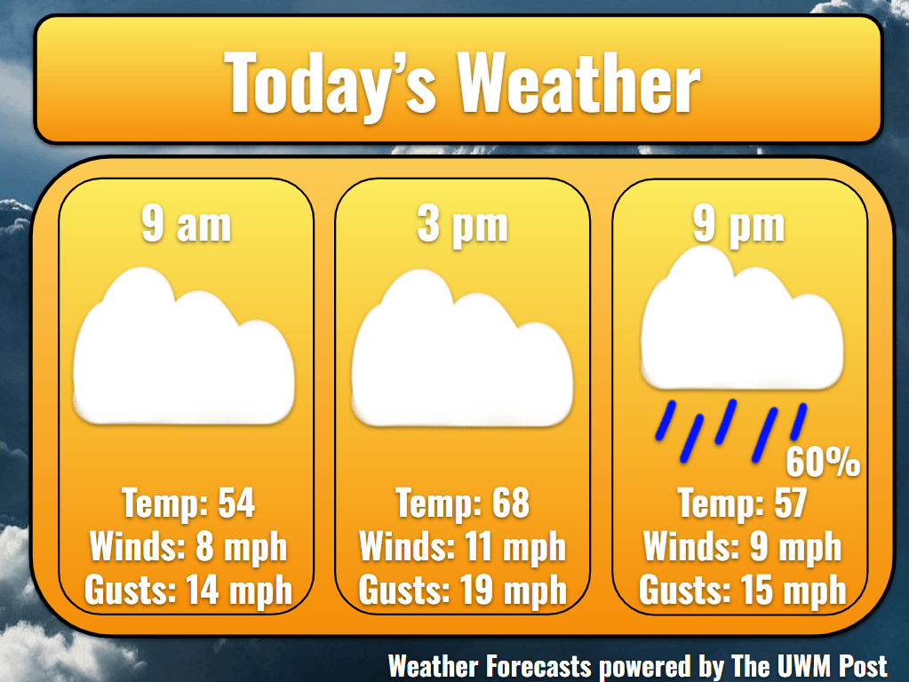
Today: Clouds dominate the day after another morning of patchy fog. Forging onward underneath the clouds, southern winds provide the warmth to peak at 70 by 2 p.m. With a low-pressure system strengthening in the north, we experience winds up to 12 mph and gusts up to 22 mph. As the day progresses, winds turn slightly to the southeast to bring in some cooler temperatures for the evening.
Tonight: After sunset at 5:54 p.m, temperatures quickly retreat back to the upper 50s. Winds continue at 8 mph overnight. Popping up after 6 p.m., some isolated showers weave through the I-94 corridor, potentially reaching downtown Milwaukee by 9 p.m. Though it may dampen the pavement here and there, this shouldn’t dampen Milwaukee’s spirit for those at Game 2 of the World Series. Drizzles exit by midnight to make way for more clouds. Dropping to 53, temperatures set up to launch tomorrow into the 70s again.
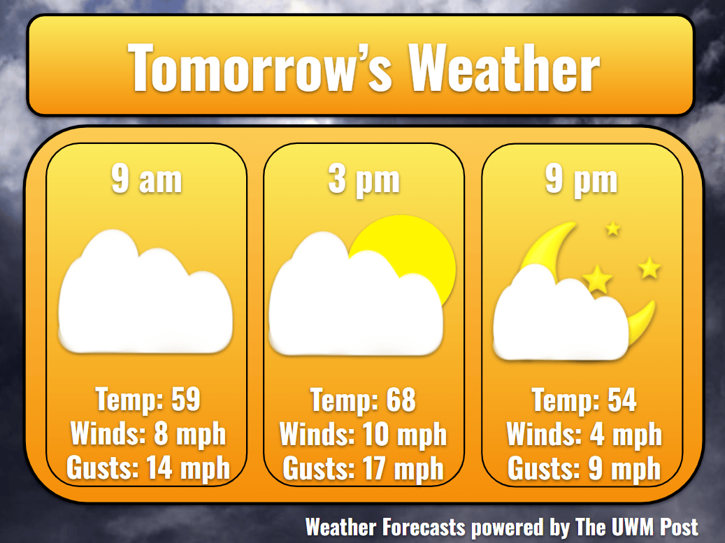
Tomorrow: Along with the sunrise, temperatures rise into the 60s at 10 a.m. with some rays of sunshine. Temperatures ride a consistent 10-mph southern wind to the high of 73 by 2 p.m. Central Wisconsin rain showers tilt south, but then trek north with an upper wind shove, so Milwaukee sees mostly clouds for the day. Despite the retreat, some winds make their way down the shoreline to meet Milwaukee later in the day. This sends temperatures back into the 60s, and it could be accompanied by some fog, so stay safe on the roads.
Tomorrow Night: Winds now have begun to strengthen from the northeast and gusting up to 25 mph. With this, temperatures fall back to 52 for a low. At the end of the night, clouds attempt to break up with the entering of a high-pressure system.
Monday: Though fair weather favors Milwaukee for the first day of the work week, temperatures struggle to touch 60 degrees. Blowing out of the northeast for most of the day, winds average 12 mph with gusts nearing 30 mph. To our west, a low pressure challenges our high pressure, creating some showers which travel up the Mississippi River. These should not extend to Milwaukee, so we stay dry, even on Tuesday. Although far off, winds are influenced, maintaining their 12-mph clip into Wednesday. Overnight, temperatures drop to 50.
Tuesday: Beyond Monday, weather models increasingly disagree due to this low pressure and another farther out west. Rain stays west of Milwaukee Tuesday, though a shift in the low’s track might cause some pop ups in the early morning. Temperatures stick around 61 with winds out of the east, gusting to 25 mph. Turning to the south after sunset, gusts grow to 30 mph by Wednesday. Temperatures only get down to 53.
Extended: Further into the week, models disagree on specific timing and depth of the low pressure. This induces more variability into the forecast. For now though, this low should track northeast, avoiding Milwaukee until Wednesday night. Some rain enters the area between Wednesday night and midday Thursday, dropping around a tenth inch of rain. After exiting, winds should calm to 8 mph by Friday. Most of the wind should come from the south, and temperatures should reflect this with upper 60s highs and lower 50s lows. Partly cloudy skies lead us into an uncertain holiday weekend for weather. Stay tuned for your weather updates!
